
Only because it’s so much more gripping to actually see it like this… What I found most shocking and didn’t know was how much of the West was initially set apart as Indian lands — most of Montana, most of Oklahoma, large parts of the three West coast states — and were then taken away anyway.
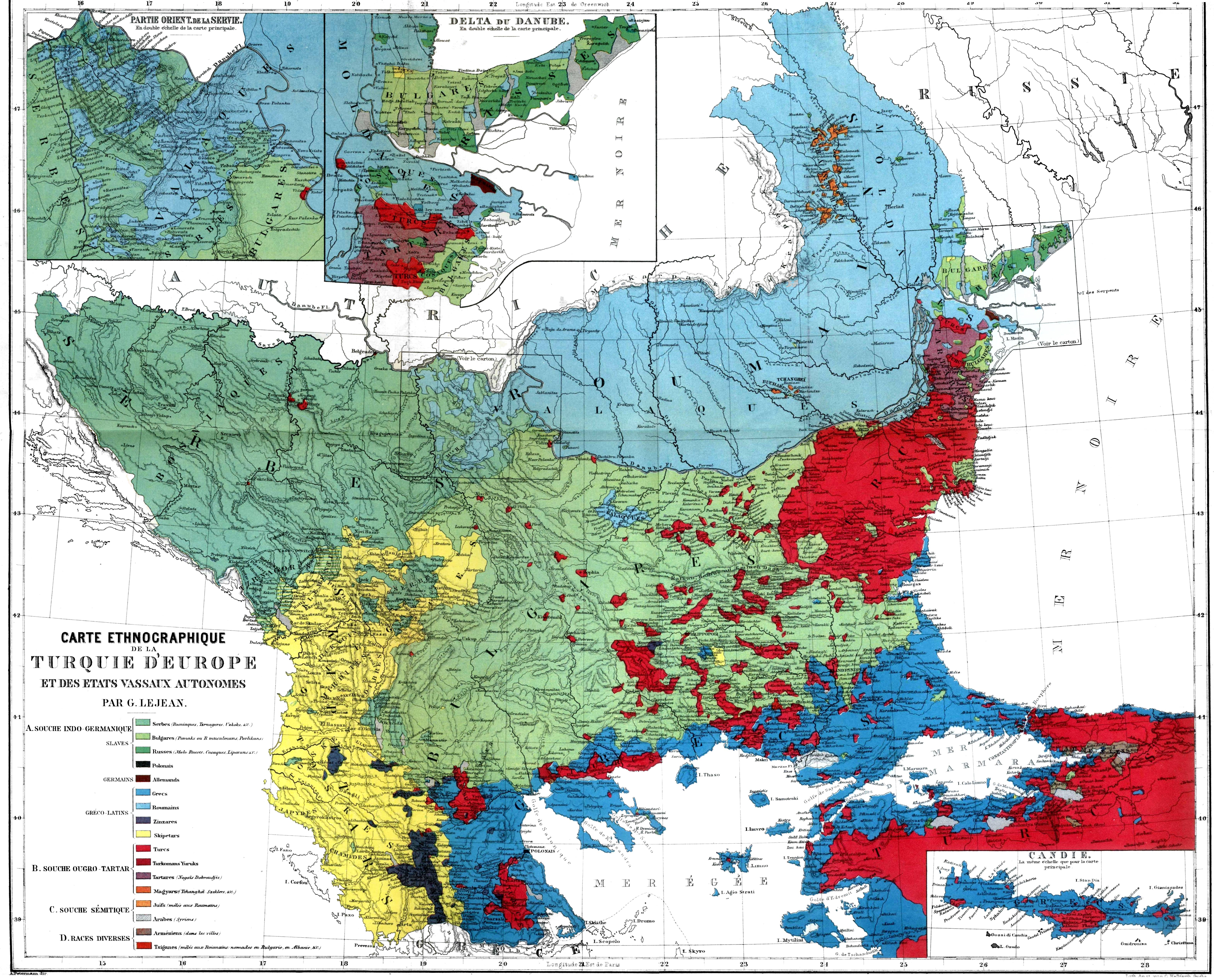
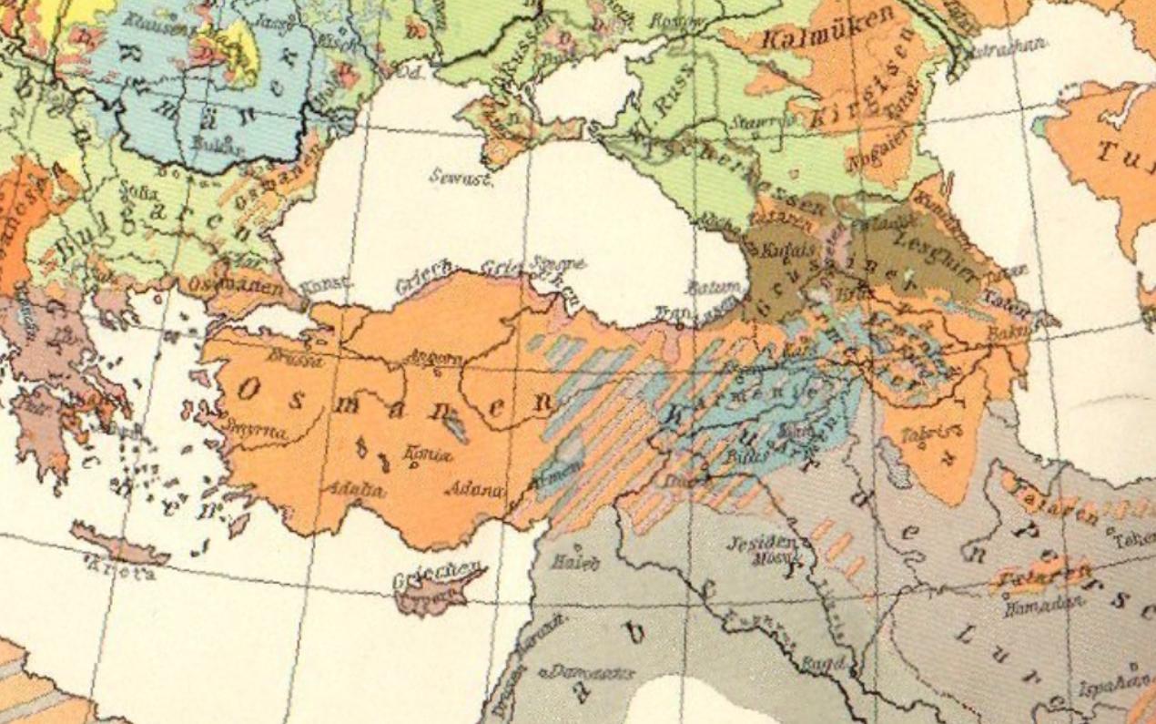
I have a ton of old nineteenth-century ethnographic maps of the Balkans and Anatolia, partly because I love to look at the physical, concrete portrayal — even if it’s just in shapes and colors — of us living together.
It would be fantastic if someone could produce a time-line series of maps, like this one of Native Americans, of the Christian exodus from Anatolia — 11th or 20th century — or the progressive ethnic cleansing of Muslims from the Black Sea and the Balkans over some two-hundred-plus years.


–
Comment: nikobakos@gmail.com
–

Leave a comment